Southwest Road Trip Part 3: Coral Pink Sand Dunes

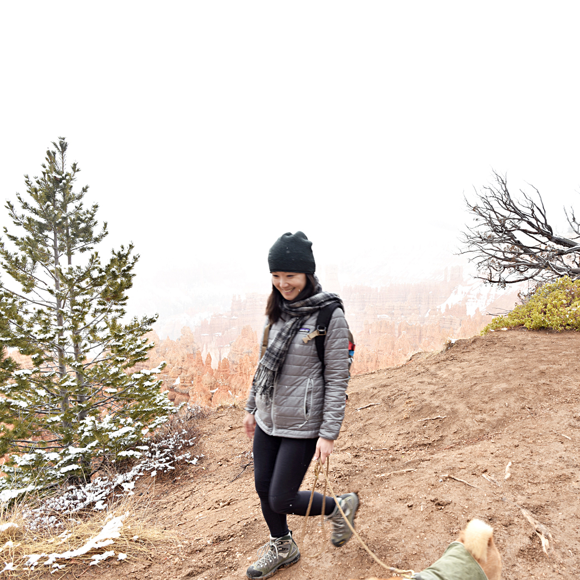
"You're in for a real treat today" the ranger told us as we paid the entrance fee to the Coral Pink Sand Dunes State Park, located just outside of Kanab. And indeed it was. Last night's snowfall over the dunes had created a sort of strange but wonderful contrast of white snow over the park's signature bright pink-orange sand. It was the third day of our Southwest road trip and while we had loved every moment of our snowy adventure to Bryce Canyon National Park, we were glad the sun had finally decided to rejoin us. 

DSC_4145.jpg
DSC_4165_02.jpg
DSC_4220_03.jpg
DSC_4308.jpg

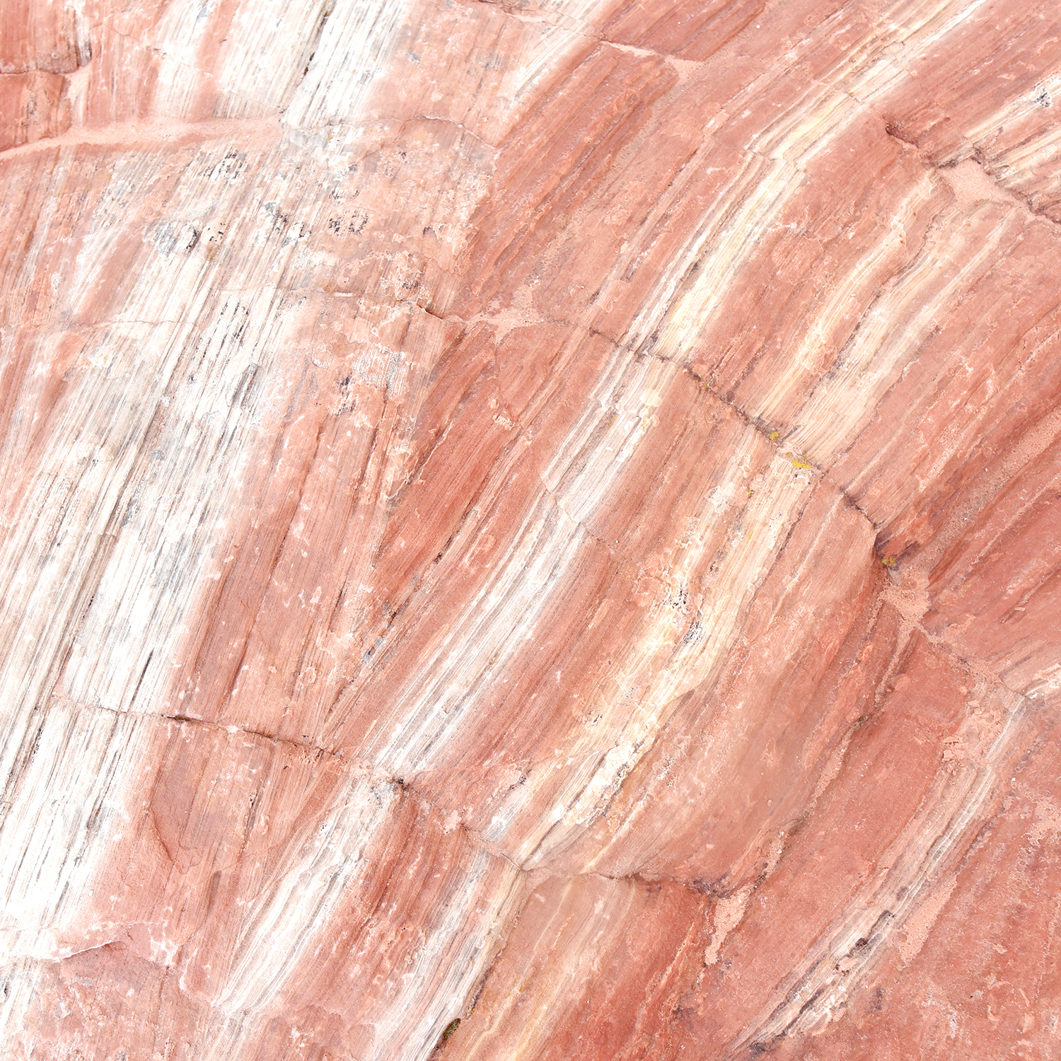
There was no distinct hiking trail within the dunes as the wind constantly shifts the sand as much as 50 ft in a year.  So we set off past the wooden fence, careful to watch for ATVs and headed straight up the first hill we saw. There was less snow past the fence, which gave us a better sense of just how vibrant the color of the sand really was. 

Backtracking a little...

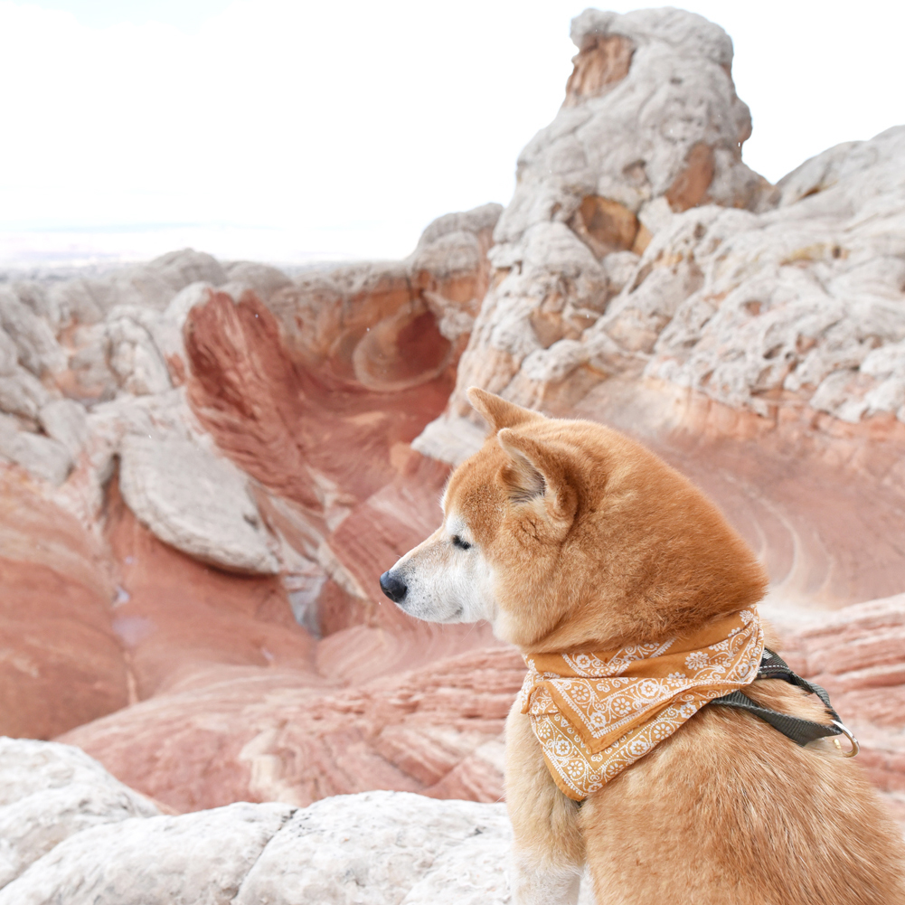
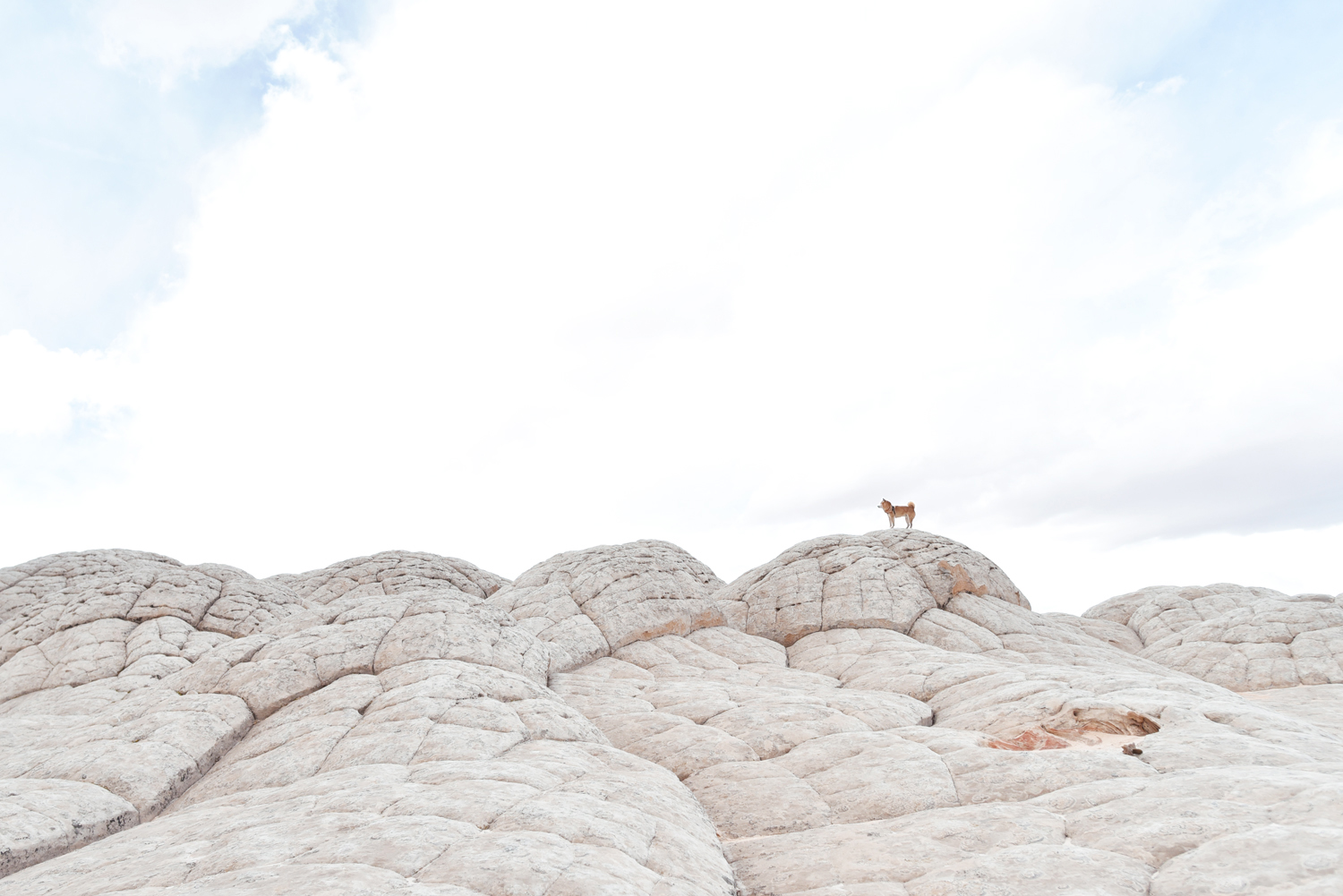
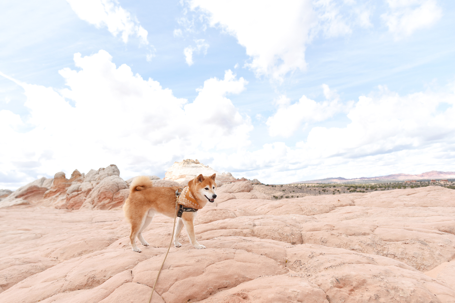
We had seen a sign for the dunes on our way to Bryce the day before and figured we'd check it out the next morning before venturing into Zion National Park. Fully anticipating that our time in Zion would be less exploring on our feet and more sightseeing from the car due to the park's strict rules on dogs, we wanted to get some real hiking in first. And the dunes did not disappoint. Hoku had a blast here. The vastness, the fact that we pretty much had it all to ourselves that day, it almost felt like we were the last two people and dog left on earth. (Well, despite the occasional ATV zooming past us from time to time.)

20180316_113537_2.jpg
DSC_4340_2.jpg
DSC_4606.jpg
DSC_4319_02.jpg
DSC_4367.jpg

Sometimes the best parts of an adventure are the parts that are unplanned. The moments that are fantastically serendipitous because you just so happened to notice a small sign off the side of the road and said, sure why not? This planner is definitely learning to embrace spontaneity. 

DSC_4492.jpg

Southwest Road Trip Part 2: Bryce Canyon National Park

The day after our White Pocket tour, the forecast in Kanab was rain. All. Day. Long. Our original plans were to hike through the slot canyons of Wire Pass and Buckskin Gulch, but were warned that the road to get there would most likely be slick and muddy. So what does one do when it rains at 5000'? Head to 8000' and play in SNOW, of course. So after another unsuccessful morning at The Wave lottery, we started on the hour and a half drive from Kanab to Bryce Canyon National Park through Dixie National Forest. Along the way, we stopped in the local Dollar Family to pick up two Lunchables (the ham and cheese ones) and a can of Pringles because 1. we are still the kids who met in third grade and 2. this was vacation and diet be damned.

DSC_3584.jpg
DSC_3602.jpg

After a snowy drive in, we arrived at the Bryce Canyon park entrance, renewed our annual National Parks membership, and headed straight for the dog friendly trail between Sunrise Point and Sunset Point that overlooks the park's namesake Bryce Amphitheater. The red hoodoos covered in a layer of crisp white snow was even more magnificent in person than in pictures. I swear the two of us let out a "Wow" in unison as it all came into view while Hoku probably thought, Oh, a gray canyon... 

DSC_3617.jpg
DSC_3636.jpg
DSC_3690.jpg
DSC_3788_03.jpg
DSC_3750_02.jpg
DSC_3933.jpg
DSC_3848.jpg
DSC_3845_02.jpg
DSC_3702.jpg

It snowed intermittently as we walked along the rim of the amphitheater, washing out the views in a veil of white but to be honest the snow showers were my favorite part of the entire day. It was Hoku's first snowfall and to have it happen against the backdrop of this incredible red canyon was pure magic. 

DSC_3813.jpg
DSC_3820_02.jpg

Afterwards, we started on the 20.5 mile Bryce Canyon Scenic Drive in hopes of hitting up all the dog friendly view points along the way. As we made our way to Rainbow Point, the highest lookout in Bryce Canyon at 9115', my secret wish for more snow came true. I didn't even mind that there was hardly a view there at all. While everyone else huddled in their cars to wait it out, we gleefully ran through the flurries and played in the snow (as any level-headed Hawaiian turned Southern Californian would) until our dog turned into a four-legged popsicle. 

DSC_3949.jpg
DSC_3956.jpg
DSC_3994.jpg
DSC_3991.jpg
DSC_3972.jpg
DSC_3963_A.jpg
DSC_3963.jpg
DSC_3963-C.jpg
DSC_4017_02.jpg
DSC_4020.jpg
DSC_4026.jpg
DSC_4027.jpg

After Rainbow Point, it didn't seem like the snow would be easing up anytime soon so we decided to call it a day before the weather worsened. On the way out, we made a quick stop at the Visitor's Center to pick up some souvenirs. Hoku waited patiently for us in the car, all cozied up in his sherpa blanket while the snow continued to fall outside. When we returned, David surprised him with a new coyote friend. We had to get a souvenir for him too, of course. It was love at first sight and they became fast travel buds as you can see from crappy phone photo below that was too cute not to share!

It was a really, really good day. Snow makes everything better. 

IMG_1580.jpg
DSC_4042_02.jpg

Southwest Road Trip Part 1: White Pocket

After a 7 hour drive from LA, we finally arrived at our hotel in Kanab at 1am. We had watched (with a little too much sleep-deprived, delirious astonishment than it probably deserved) the satellite clock in our Outback jump back and forth an hour as we entered and exited Arizona twice. We were going to be team Little Sleep and wake up early to get to the Kanab BLM Visitor Center at 8:30am sharp to enter the lottery for the ever elusive Wave. We had entered the online lottery twice before, but this was the first time we would attempt to enter in person.

That morning, there were 53 groups ranging from 2-6 people. The forecast for the next day was rain. Still, we were all determined. There were people from all over the world who had traveled a long way in hopes of being one of the lucky 10 chosen. Every group was assigned a number and with breaths held and fingers crossed tightly, we all watched as the bingo cage began to roll. Winners were called, followed by enthusiastic cheers and whooping. Sadly, we were not one of the lucky ones, but there was so much to explore in the area that as the BLM ranger would say in his well-rehearsed speech, "The Wave is only a drop in the bucket."

After the lottery, we had planned a trip to White Pocket with Dreamland Safari. (Shoutout to our awesome tour guide, Orion.) The deep, sandy road to get there is notoriously difficult to navigate, requiring a high clearance 4WD vehicle and off-roading skills. Plus, a $1000 towing fee was not something we wanted to risk. 

DSC_2666.jpg
DSC_2678.jpg

Situated on the Arizona side of the Utah-Arizona border and just a stone's throw from The Wave, White Pocket is a diverse and expansive, other-worldly, twisty, gnarly, holey, bulgy, stripy sandstone landscape ranging in color from whites and grays to all the shades of pale reds, yellows and oranges. White Pocket gets its name from the pockets of water that collect in large pools as well as its uniquely white, calcium-rich surrounding rock formations. Exploring the area does not require a permit and fortunately, the mere fact that it is so difficult to get to has been excellent for crowd control. (There is talk that a permit system may be instated in the future as the area gains popularity.)

DSC_3319.jpg
DSC_3309_2.jpg
DSC_3329.jpg

This red, striated slot canyon like section is The Wormhole. At the end of the Wormhole is a dark red dot called the Clamshell. The white, bulgy area with the famous lone tree is very appropriately called the brains. 

DSC_3280.jpg
DSC_3104.jpg
DSC_3196.jpg
DSC_3050.jpg
DSC_3240.jpg
DSC_3237_1.jpg
DSC_3155.jpg
DSC_2860_2.jpg
DSC_2813_2.jpg
DSC_2762.jpg

This pool of water and the surrounding white brain-like formation is how White Pocket got its name. To this day, ranchers in the area will take their cattle to this watering hole to drink as evidenced by the cow patties we found. 

DSC_2868.jpg

Two of the coolest things we saw were these beautiful petroglyphs of Bighorn Sheep preserved in the red sandstone and an almost perfect Native American chert arrowhead. 

DSC_2709_2.jpg
DSC_2724.jpg
DSC_2831.jpg
DSC_2965.jpg
DSC_2848.jpg
DSC_3091_2.jpg
DSC_2923.jpg

This rock formation with the candy-colored stripes is known as The Lollipop. 

DSC_2943.jpg
DSC_3251.jpg
DSC_3178.jpg
DSC_2798.jpg
DSC_2787.jpg

Halfway through the tour, we returned to the vehicle where a spread of cold cuts and fresh veggies were laid out for us to construct our own wraps and sandwiches. Not to be left out, Hoku munched on cucumbers and bell peppers.

It showered on us throughout the day, but the weather held up for the most part and it was fascinating to see the landscape in all sorts of light. David and I are already talking of returning to experience Dreamland's overnight camping tour. I can only imagine how stunning White Pocket is at sunrise and sunset. We couldn't have asked for a better way to kick off our Southwest adventure.

DSC_3467.jpg