Distance: 17 Miles | Elevation Gain: 5,840 Ft | Campsite: High Creek Camp
We pulled in to a pitch black trailhead parking lot at 5:30am, the headlights of our Outback eerily illuminating two other parked cars. It was the first time we'd be starting a hike in complete darkness and I was admittedly a little nervous. But as we left the warmth of our heated seats and stepped out into the brisk morning air, all apprehension was replaced by awe at an early morning sky full of stars that were definitely not visible when we left the city just a couple hours earlier. Shortly after, another vehicle arrived and I half jokingly asked David if he thought they were hikers or hooligans. "Do hooligans drive Land Rovers?" he replied, cool as a cucumber. Seconds later, two women stepped out in stylish hiking gear and we chuckled. Yep, definitely hooligans. With our packs strapped on and GPS activated, we walked out into the blackness to begin the first couple miles with just our headlamps, the moonlight and of course the sound of Shiba paws to guide the way.


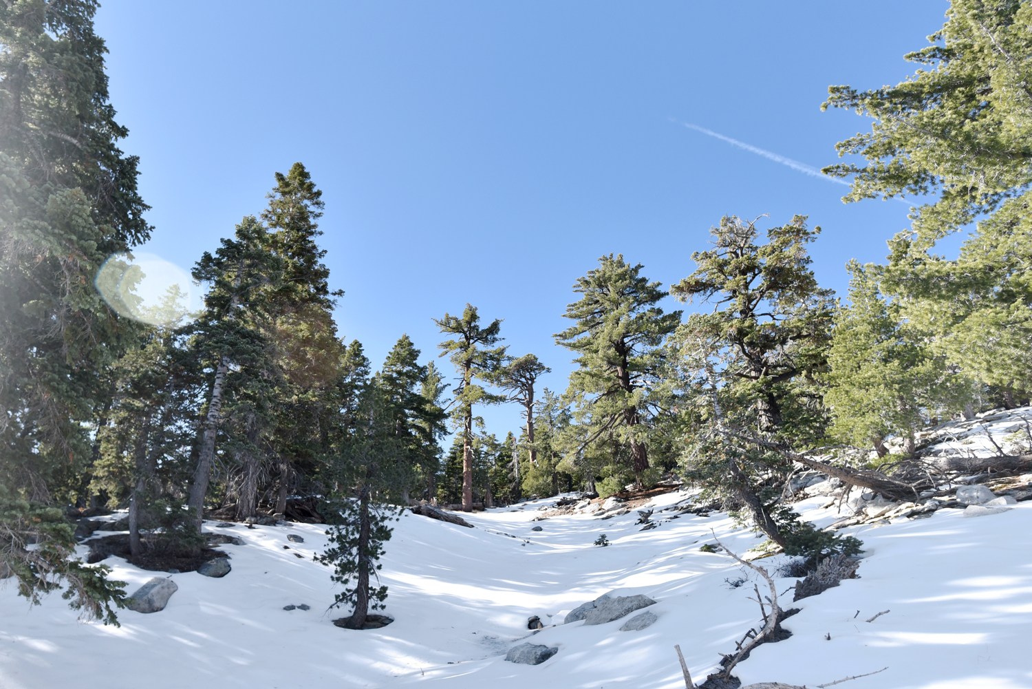
Halfway up the steep 1000' vertical ascent that begins after the Mill Creek crossing, there was finally enough light in the sky for us to ditch the headlamps. At the end of one of the switchbacks, there was an opening looking out over Mill Creek Canyon and we took a second to take in a well-earned view, just made all the sweeter by the glorious layers of a dawn sky.


We reached Half Way Camp by 8am and debated whether to set up home base there or continue on another 2.5 miles to High Creek Camp, which would have significantly better views and is also the more popular of the two campsites. We decided to carry on and booked it to High Creek by 10am.


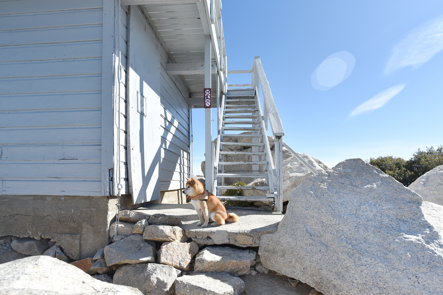
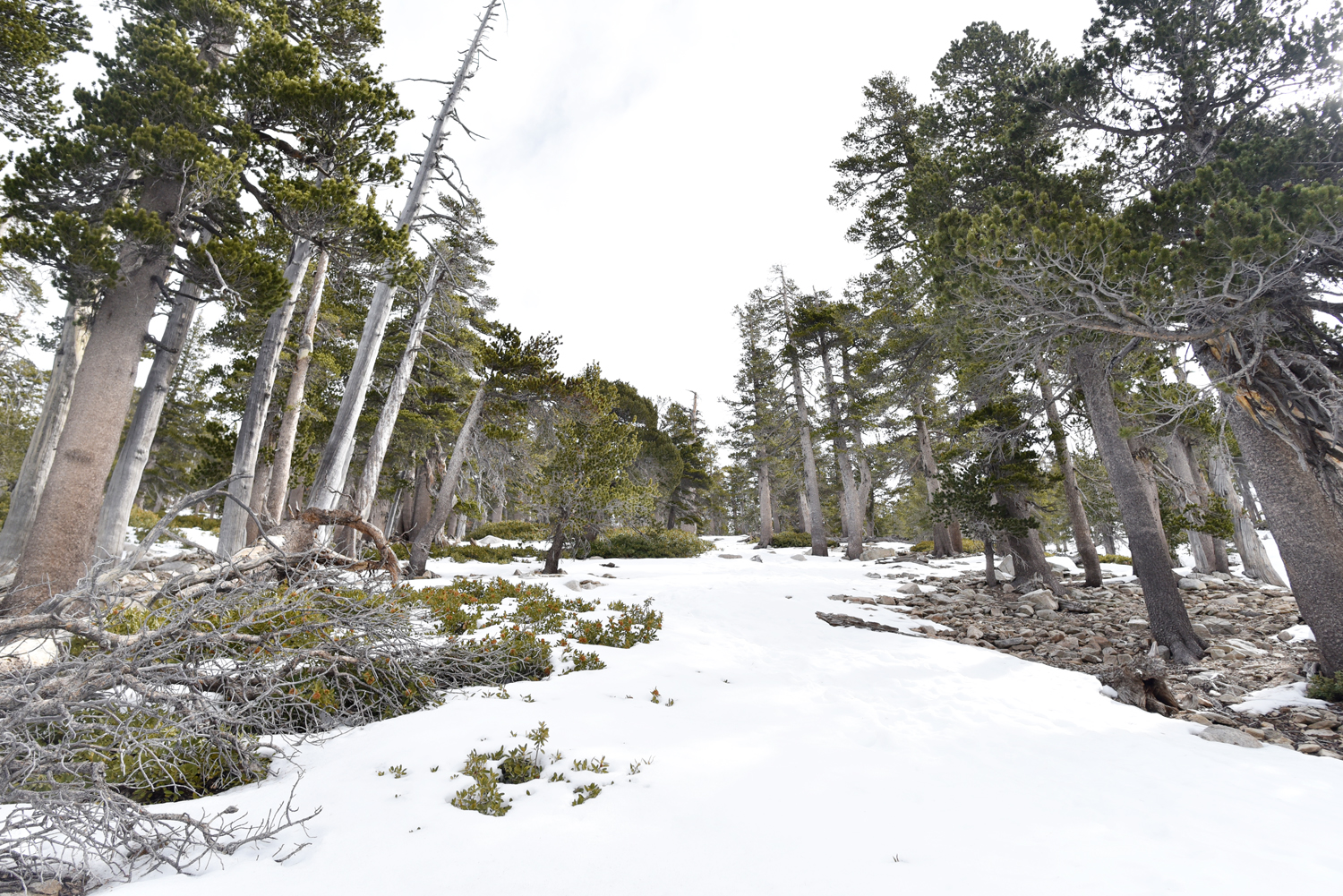
The rangers had warned us of snow and ice starting from 7500' so we were fully expecting the possibility of camping on snow since High Creek sits at 9200'. To our pleasant surprise, most of the campsites were dry and we found ourselves a spot with a good view and decent wind protection. We pitched our tent, swapped our heavy packs out for lighter day packs all too gladly, and pressed onward for the final, dreadful 3 miles to the summit. I know 3 miles doesn't sound all that bad on paper, but imagine it at altitude (which makes breathing more labored) through ankle deep snow after hiking a good 6 miles with 25lb and 30lb packs. Let's just say that the only one having a grand old time the entire way up was the dude with four legs.


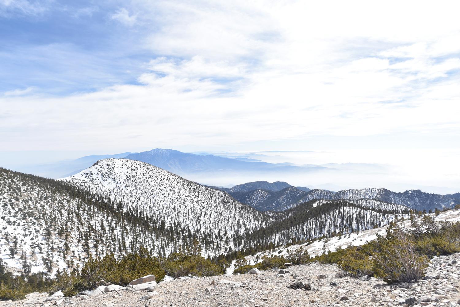
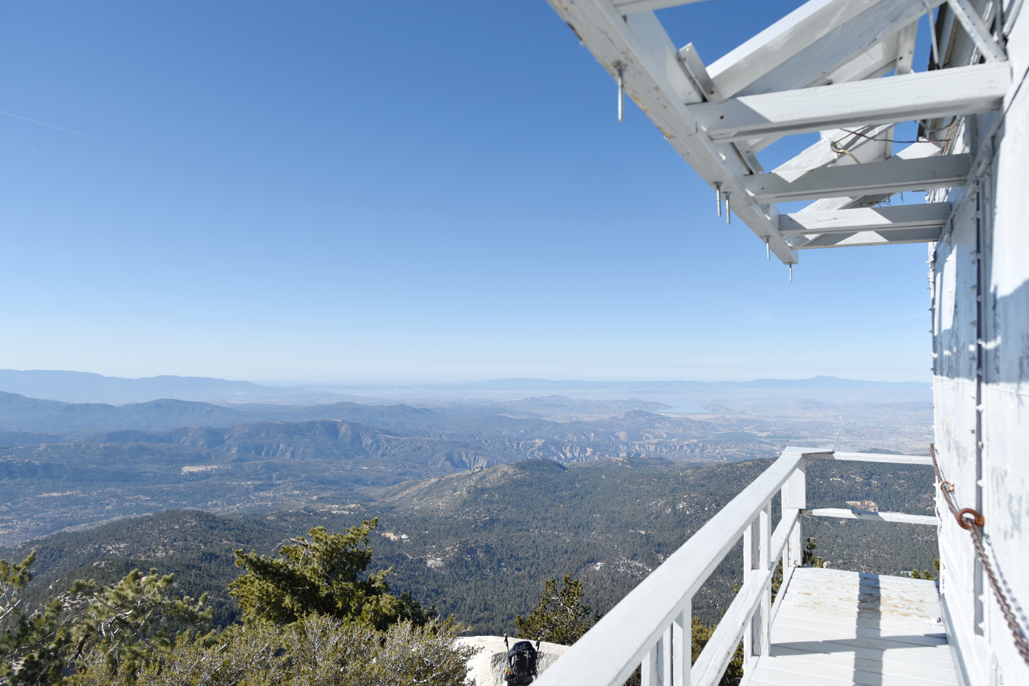
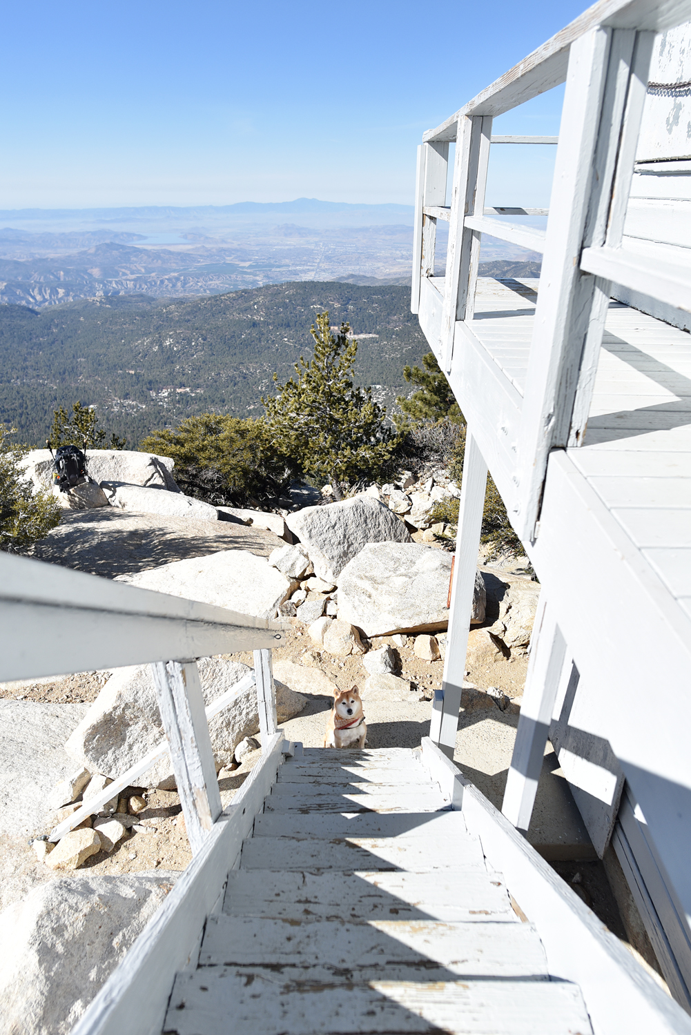
About a half mile from the summit as we were trudging up the windy, diagonal traverse below the ridge, we started noticing that some hikers ahead of us were turning around. I looked ahead to the saddle leading to summit and saw snow literally being blasted into the air and swirling around before disappearing into the wind. They had tried to figure out a way to pass, the (bigger and stronger than us) hiker said, but it was impossible to even stand up straight. We stared at the summit, visible in the distance, just calling to us like the one ring. We had come so far. But hey, 11,000' was just as good as 11,503' if it meant living another day. A mountain as high as San Gorgonio pretty much makes it's own weather, and if it decides that you shall not pass, you respect it. If you're wondering what the summit actually looks like, prepare to be not that awed by this photo we took back in 2015.


So back down the mountain we went, a little disappointed but secretly a little relieved. Back in 2015, we had said "never again" to San Gorgonio, but here we were again, suckers for punishment. I had wondered since then if Hoku, being older than the first time he climbed this mountain with us, would ever be able to do it again. And the answer was a resounding yes. And he schooled us, just like the first time. And I'm pretty sure he could do it again in another three years.


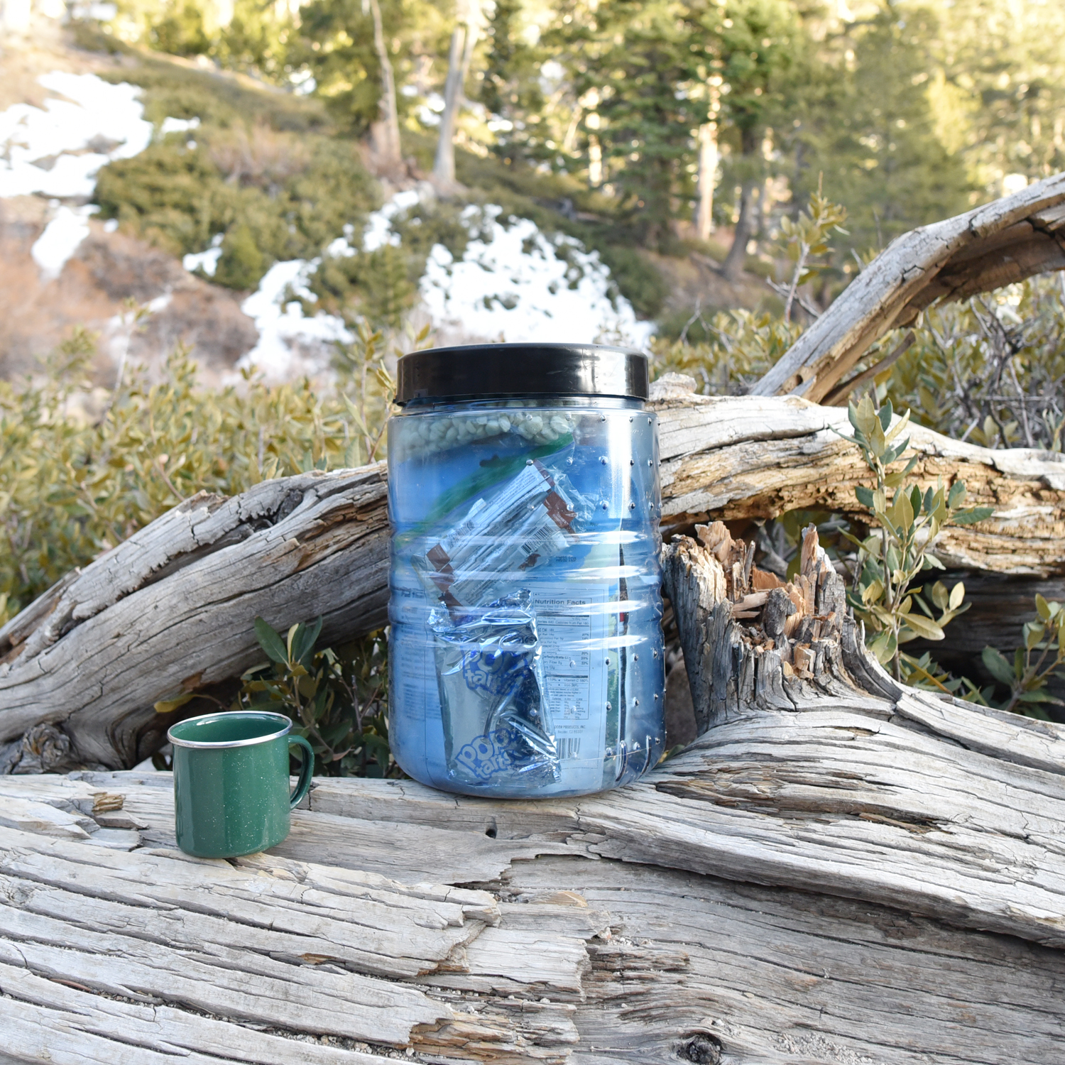
We returned back down to 9200' to find our campsite awash with magic hour light. Using our new, super light Snow Peak LiteMax stove (which replaced our heavier Jetboil) we made and scarfed down a dinner of Backpacker's Pantry Kung Pao Rice with Chicken. While it was decently edible, I would not recommend it for cold weather, high altitude camping. Not only does it take twice as long to cook at higher altitudes, meaning that it will not be hot when you're finally able to eat it, it also includes these two packets of peanuts and chili flakes that are sealed in cold finger-proof, industrial grade thick plastic without easy to open tabs. A real PITA.
The real treat was a cup of hot instant tofu miso soup that David so thoughtfully packed in the bear bin for me. My absolute favorite camp food. Next time, I'll pack a little ball of rice to add in and it'd be perfection.


↑A beautiful view of the "switchbacks of death" from our camp.


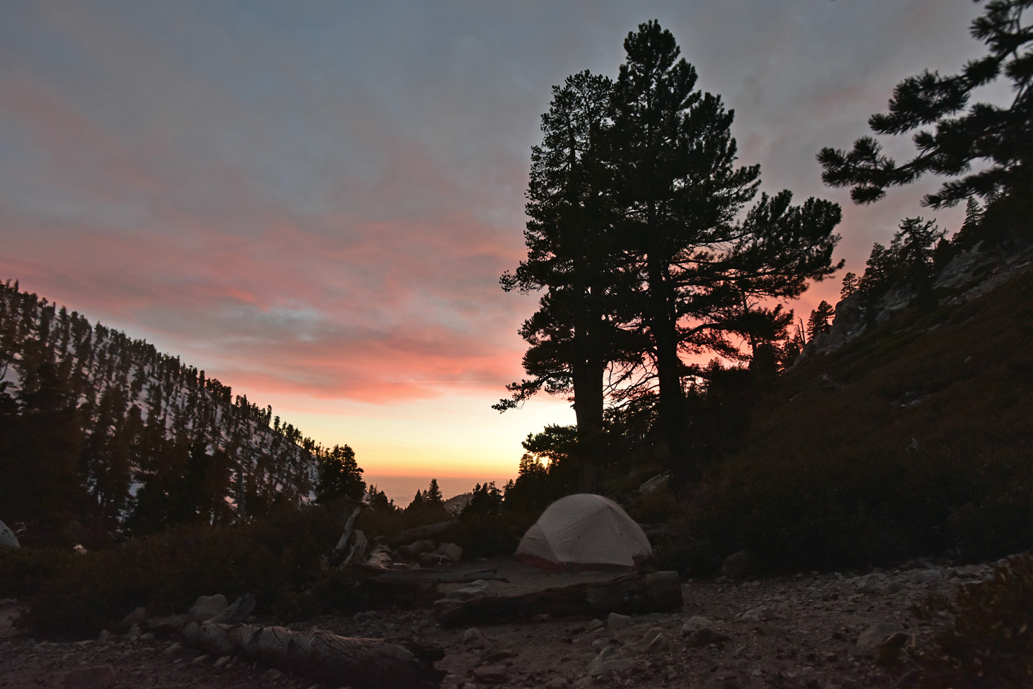


We watched the sky change from a fiery orange to vibrant purples and pinks before calling it an early night, tucking into our sleeping bags at about 7pm. The winds gusted sporadically and we drifted to sleep feeling downright fortunate to have an all-encompassing shelter, unlike our crazy camp neighbors who were um, sleeping in hammocks. At 3am, our alarms went off and we awoke to an ungodly chill of 15° F. I squinted out of my sleeping bag to find David and a Rumpl-wrapped Hoku staring down at me. "Happy birthday," he grinned with a slight shiver. (Yes, the hilarity of choosing to wake up in a freezer on my birthday does not elude me.) We quickly ate a breakfast of frozen energy bars washed down with hot coffee before packing up camp at lightning speed to keep warm. With headlamps lighting the way, we began the long trek down the mountain, fueled by thoughts of a large bowl of hot pho waiting for us upon our return to civilization.

So there we were, two humans and a dog, hiking together down the tallest mountain in Southern California at 4:30am, to the sound of microspikes crunching into the ice beneath our feet, under the canvas of this insanely stunning starry sky. (Can you spot Jupiter and the constellation Hydra?) I don't think I've ever rang in a birthday in such a surreal and unbelievably epic way. Here's to 33. I think it's gonna be a good one.